This Community Area Plan (CAP) is one tool to support implementation of the citywide Charlotte Future 2040 Comprehensive Plan and the Charlotte Future 2040 Policy Map, providing more detailed guidance for land use, building form, mobility, open space, and public facilities for the East Middle & Outer community-level geography. At this scale, the East Middle & Outer CAP provides a coordinated, efficient, and effective structure for identifying nuanced and locally-specific needs and priorities. It also provides a structure for developing strategies and recommendations -to address those needs and priorities and for contributing to the community’s overarching goal to create a more equitable Charlotte.
This E-Plan serves as a summary of the complete, adopted East Middle & Outer Community Area Plan, which can be viewed by following the link below.
On November 24, 2025, Charlotte City Council decided to delay action on this Community Area Plan and the Revised Policy Map for this area to allow for more community input. Additional engagement opportunities are being planned, and more information will be posted on the project website. Plans for these areas will stay on the project website until Council makes a final decision.
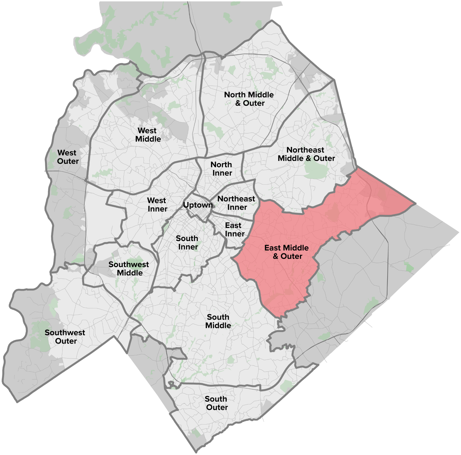
East Middle & Outer Location Map – Click to enlarge
Community Area Profile
The East Middle & Outer geography is roughly bounded by Shamrock Drive, Robinson Church Road, and Reedy Creek to the north, City of Charlotte limits to the east, Sardis and Randolph Roads to the south, and Wendover Road and Eastway Drive to the west. The area includes several major avenues and Independence Boulevard radiating outward from Uptown as well as several east-west avenues which provide high-capacity or express transit service. The area is primarily auto-oriented with a focus on low-density, single-family residential development. Currently, the area is predominantly characterized by the Neighborhood 1 Place Type with additional concentrations of Commercial and Parks and Preserves Place Types. The East Middle & Outer geography is currently home to 143,578 residents (16% of the City’s population) with slightly lower education rates and slightly higher racial and ethnic diversity than the citywide averages. By 2040, this area is expected to grow by 14,481 residential units and 5,295 new jobs (9% and 2% of the city’s total growth, respectively).
Understanding these current conditions and expected growth patterns help in determining the specific needs and priorities for the East Middle & Outer area. Specifically, this profile sets the foundation for understanding how local growth and change can contribute to a more equitable city for all by increasing opportunity and access and by reducing harmful impacts. More information about existing conditions can be found in the East Middle & Outer Community Report.
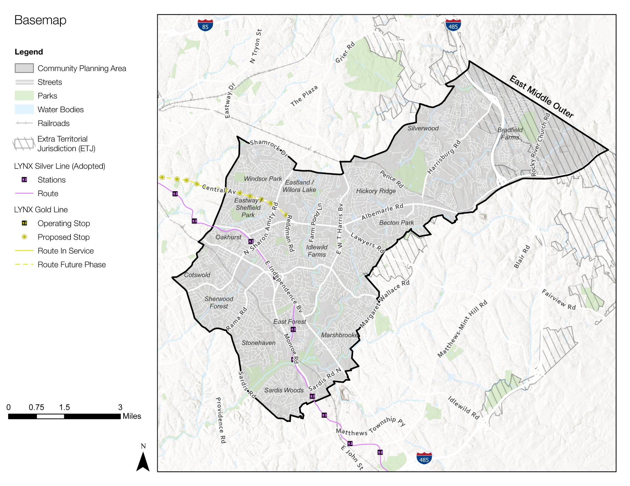
East Middle & Outer Area Map – Click to enlarge
Expected Growth
The East Middle Outer geography is projected to see an increase of 14,481 residential units, which is 9% of the city’s overall residential growth, and 5,295 new jobs, which is 2% of the city’s total job growth, by the year 2040.
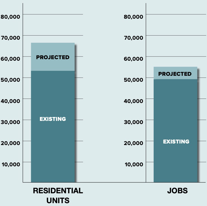
Data Sources: American Community Survey (ACS) 2019, Quality of Life Explorer (QOL) 2020, Community Viz Model 2020, CPA Prioritization Matrix 2019